Understanding Kullu
Kullu, one question
at a time
I live in the Kullu Valley, and I have a lot of questions about it. Is there more forest than there used to be? Are the fields turning into orchards? Each post here takes one question and tries to answer it properly.
The approach comes from Our World in Data, where a clear question and a good chart do most of the work. I wanted to do the same for one place, and go deeper. So I set what I’ve seen living here, and what the valley’s history tells us, next to satellite data and government records. Sometimes they agree. The posts get interesting when they don’t.
October 2026
Is Kullu losing its forests?
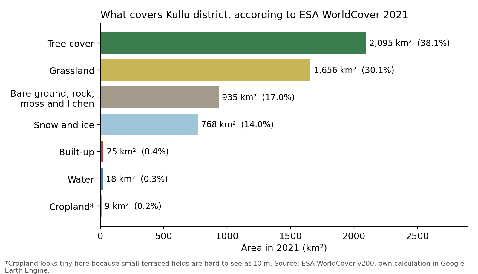
What covers Kullu district, how far different datasets agree, and what the Forest Survey of India and two satellite datasets say about tree cover over the last two decades.
Read →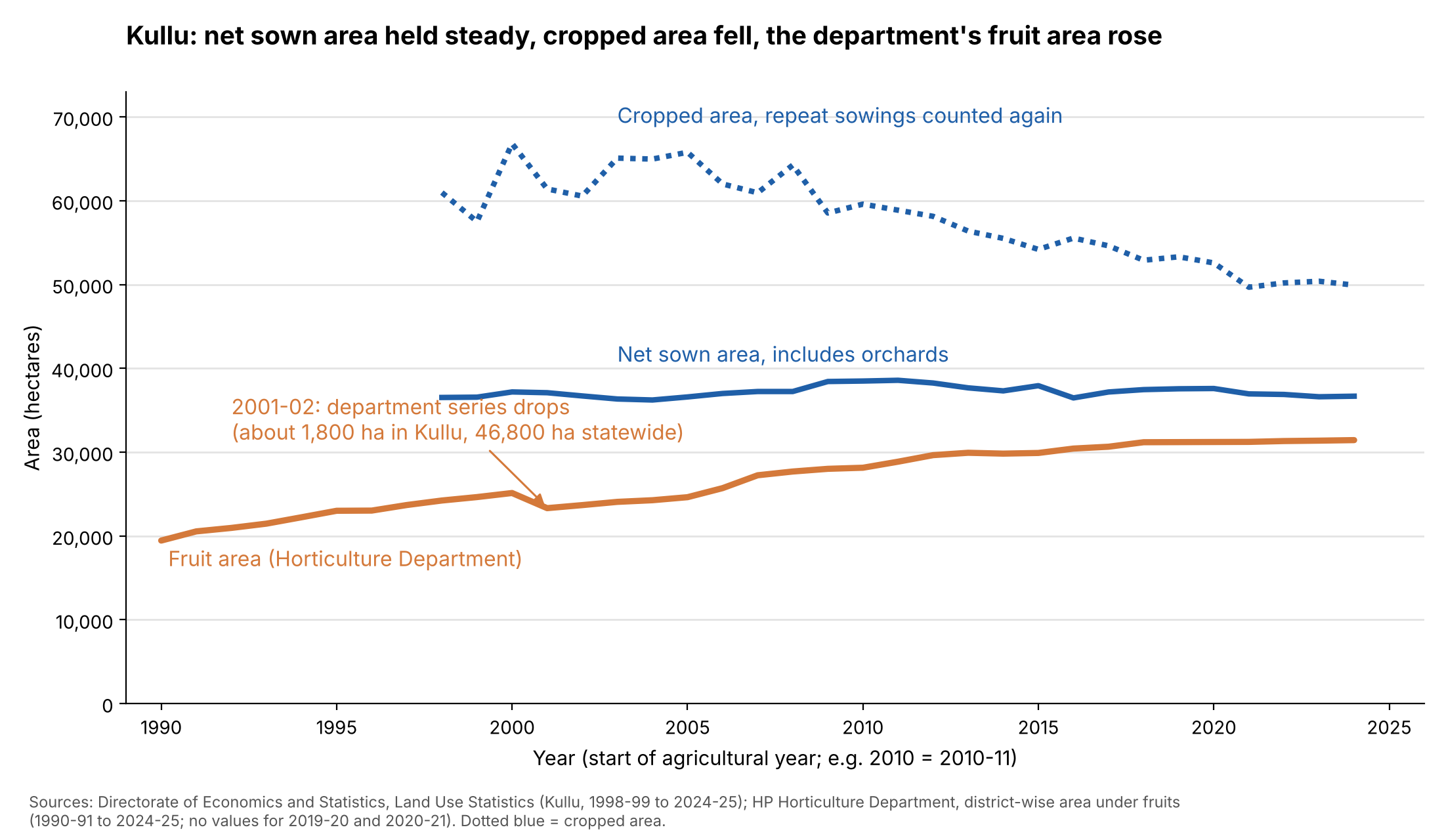
November 2026
Is Kullu losing its fields to orchards?
Government records say Kullu has about 37,000 hectares of sown land. Satellites find a few thousand. Where the gap comes from, and what it says about fields turning into orchards.
Read →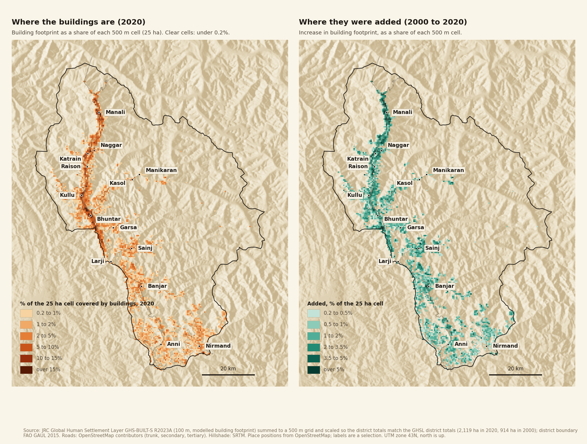
November 2026
Is Kullu building its way out of the valley?
Buildings and roads cover about half a per cent of Kullu district, and building area has more than doubled since 2000. About half of it still sits along the Beas, but the new growth is moving into the side valleys.
Read →